Peak District Guided Walking Tour 2025

0
Price
From$2,350 pp
Price
From$2,350 pp
Full Name*
Email Address*
Your Enquiry*
* I agree with Terms of Service and Privacy Statement.
Please agree to all the terms and conditions before proceeding to the next step
Save To Wish List

Adding item to wishlist requires an account

2761

Why Book With Us?

  • Over 25 years of exceptional service
  • Hand-Picked tours & accommodations
  • Preferred Suppliers & Rates

Contact us...

Our experienced travel designers are ready to arrange your travels.

1-888-597-3519

905-639-9954

dhtour@dhtour.ca

8 Days / 7 Nights
Availability : February, April to October
Start: The Peveril of the Peak, Dovedale, Derbyshire, England
End: The Peveril of the Peak, Dovedale, Derbyshire, England
Peak District Guided Walking Tour: 7 nights based at The Peveril of the Peak, Dovedale, Derbyshire

Contact DHTour at 1-888-597-3519 or 905-639-9954 or dhtour@dhtour.ca to book.

An introduction to the peaceful Peak District, this guided walking holiday rewards with magnificent trails, visit-worthy historic attractions, and comfortable accommodation in Thorpe – the tiny village less than a mile from the famous Dovedale Stepping Stones. There’s plenty of sightseeing greats nearby, including the Twelve Apostles that is best viewed from the limestone promontory known as Lover’s Leap.

Tour Details

Highlights:

  • Discovering the best landscapes the Peak District has to offer
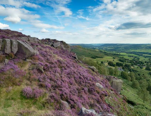
  • Admiring open moorlands and stunning countryside
  • Being close to the famous Dovedale Stepping Stones
  • Spending time with like-minded people in the great outdoors  
  • Finding new routes and places to explore with your Leader  
  • Staying at The Peveril of the Peak, our country house in Thorpe

Pick Up Location & TIme

The Peveril of the Peak, Thorpe, Dovedale, Ashbourne, Derbyshire DE6 2AW (Google Map)
4:00pm – You’re welcome to check into the country house hotel from 4pm onwards.

Drop off Location & Time

Enjoy a leisurely breakfast before making your way onward.

Price Includes

  • High quality en-suite upgraded accommodation at The Peveril of the Peak
  • Excellent food in our country house, full board (B,L,D daily)
  • The services of our knowledgeable leader, ensuring you get the most from your holiday
  • 5 days guided walking + 1 free day
  • Choice of up to three guided walks each walking day
  • Transport to and from the walks
  • Use of our comprehensive Discovery Point

Meals

  • 7 breakfasts
  • 6 lunches
  • 7 dinners
  • 1 tea

Price Excludes

  • Airfare
  • Transfers
  • Pre / Post hotel nights
  • Travel to/from the Country Hotel (The nearest railway stations are Buxton or Derby)
  • Admissions (please allow approx. £10 per day, per person for entrances)
  • Driver / Tour Leader gratuity is at your discretion
  • Travel Insurance
What to Expect
Peak District Guided Walking Tour Walking Grade: 2 & 3.

Enjoy a full day’s walking with fellow guests and leave all the planning and navigation to us; it’s what we do best. Nobody knows the UK’s best places to walk like us. Our knowledgeable leaders make sure you’re never short of the inside story on local features, viewpoints and places of interest.

  • Unpack once
  • Accommodation at a country house hotel
  • Full Board Meals – from dinner on arrival day to breakfast on departure day
  • Knowledgeable leader
  • Choice of up to 3 walks per walking day with required transport

On our Guided Walking holidays, we believe that choice is key. Our walks descriptions will help you choose according to your interests and fitness. The walks are grouped together with care by local experts to give the best experience. 

Walking Grades Explained:

  • Grades 1 & 2 – Leisurely walking grades
  • Grades 3 & 4 – Moderate walking grades
  • Grades 5 & 6 – Challenging walking grades
What to Bring

“There’s no such thing as bad weather, just the wrong type of clothing!” goes the adage. Come prepared for all eventualities and you’ll walk in comfort as well as safety. Britain’s famous for its changeable weather, so here’s our advice on what to wear and bring.

Essentials

  • Waterproof walking boots providing ankle support and good grip.
  • A waterproof jacket and over-trousers
  • Gloves and a warm hat (it can be chilly at any time of the year)
  • Rucksack
  • Water bottle (at least 1 litre capacity)
  • A small torch (everywhere in winter, year round in mountains)
  • Sun hat and sunscreen
    Denim jeans and waterproof capes are not suitable on any walks.

Recommended

  • Several layers of clothing, which can be added or removed
  • Specialist walking socks to avoid blisters.
  • A first aid kit inc plasters– your leader’s first aid kit doesn’t contain any medication
  • Sit mat (insulated pad to sit on when you stop for a break)

You might also want

  • Walking poles, particularly useful for descents.
  • Insect repellent
  • Flask for hot drinks
  • Rigid lunch box
  • Gaiters
  • Blister kit (eg Compeed) just in case
  • Waterproof rucksack liner
Version 1 Itinerary

Day 1Arrival Day

You’re welcome to check in from 4pm onwards. Enjoy a complimentary cream tea on arrival.

Accommodation: The Peveril of the Peak (T, D)

Day 2Buxton and Goyt Valley

Option 1 – Cat & Fiddle Inn to Buxton

Distance: 5 miles (8.5km) 

Total ascent: 400 feet (120m) 

In summary: This walk begins at the Cat & Fiddle, the 2nd highest pub in England. We descend to the Victorian folly of Solomon’s Temple, then onwards to Poole’s Cavern before arriving in the beautiful spa town of Buxton

Highlight: There’s time to explore Buxton and enjoy the elegant and imposing buildings of this famous spa town. 

Option 2 – Goyt Valley and Buxton Pavilion

Distance: 8½ miles (13.5km) 

Ascent: 600 feet (180m) 

In summary: Starting from the former Cat and Fiddle Inn, set high on the moors, we descend to Errwood Hall and the dam between the Fernilee and Errwood Reservoirs in the Goyt Valley. From here we cross the moors to Buxton.

Highlight: Great views from the old Cat & Fiddle Inn with its lofty position high on the moors.

Option 3 – Shining Tor & Windgather Rocks

Distance: 12 miles (19.5km) 

Total ascent: 1,600 feet (480m) 

In summary: An enjoyable hilltop route ascending to Shining Tor then following a broad grassy ridge to Cats Tor, Pym Chair to Windgather Rocks. From here we descend to the reservoirs and cross Wild Moor to Buxton. 

Highlight: The ridge between Shining Tor and Cat’s Tor enjoys great views westwards over the Cheshire Plain towards the Mersey Estuary.

Accommodation: The Peveril of the Peak (B, L, D)

Day 3Ilam and The Manifold Valley

Option 1 – Blore and Ilam Circuit

Distance:  6 miles  (9 Km)

Ascent and descent:  935ft (285m)

In summary: The walk descends to cross the River Dove into Staffordshire on an historic bridge before ascending to the hamlet of Blore.   We then visit Ilam with it’s  Park, Hall and village before crossing back into Derbyshire and back to Peveril of the Peak.

Highlight: Blore and Ilam churches both have interesting memorials. In beautiful Ilam Park we can see the River Manifold as it emerges from its underground route.

Option 2 – Blore, Ilam and Musden

Distance: 9½ miles (15km)

Ascent: 1,350 feet (420m)

In summary: We head out on the Limestone Way from Thorpe, crossing the River Dove at Coldwall Bridge and ascend to Blore. The route then continues to ascend west with magnificent views of surrounding countryside to reach Calton. We then descend through Musden Wood to Rushley Bridge before taking the riverside path through the grounds of Ilam Hall and the village of Ilam. 

Highlight: Ilam village with its grand hall, pseudo alpine cottages and memorial cross.

Option 3 – Ilam and the Manifold Valley

Distance: 12½ miles (20km)

Ascent: 1,900 feet (600m)

In summary: Beginning along the Limestone Way to Blore, we then continue to ascend, skirting the hill of Musden Low, before reaching the village of Calton. From here, the path continues north with wonderful views all around. We descend Soles Hollow to reach the River Hamps and the Manifold Way. From the confluence of the Hamps and the Manifold, the walk ascends back to the Manifold Trail to Throwley Hall. We then return through historic Ilam.

Highlight: Enjoy the panorama from Blore church over the limestone plateau and Dove Dale, with the shapely peak of Thorpe Cloud guarding the entrance.

Accommodation: The Peveril of the Peak (B, L, D)

Day 4Free day

A free day for you to explore the local area or to relax in the Country House. Our Discovery Points help you make the most out of your free day. There’s plenty of maps and a selection of the best local walking routes, as well as weather forecasts and public transport options – plus details about other places to visit. 

Accommodation: The Peveril of the Peak (B, L, D)

Day 5The Derwent Valley and Cromford

Option 1 – Crich to Cromford

Distance: 5½ miles (9km) 

Total ascent: 500 feet (160m) 

In summary: Walk from Crich village up to the monument on Crich Stand. After an undulating walk through the Derbyshire countryside we’ll follow the Cromford Canal towpath, to Cromford Wharf and Arkwright’s Mill.  

Highlight: The Derwent Valley was one of birthplaces of the Industrial Revolution, for it was here that Richard Arkwright set up his pioneering cotton mill. Its importance is now recognised as a UNESCO World Heritage Site.

Option 2 – The Derwent Valley and Cromford

Distance: 9½ miles (15km) 

Ascent: 900 feet (280m) 

In summarySoak up the views from Crich Stand, then walk over the green hills above the Derwent Valley to the timeless hamlets of Lea, Dethick and Riber. Finally we follow the canal to Cromford.

HighlightCrich is home to the National Tramways Museum. Look out for these vintage vehicles when you cross the tram tracks at Crich Stand.

Option 3 – Ambergate to Crich

Distance: 12 miles (19.5km) 

Ascent: 1,400 feet (420m) 

In summaryStarting from Ambergate in the Derwent Valley we’ll ascend the wooded valley side to Crich Stand, then continue over rolling green hills to Cromford. 

HighlightCrich Stand is dominated by the Sherwood Foresters Memorial with its commanding view over the Derwent Valley.

Accommodation: The Peveril of the Peak (B, L, D)

Day 6Dovedale

Option 1 – Dovedale Gorge

Distance: 7 miles (11km)

Ascent: 1,200 feet (360m)  

In summary: Beginning with a descent to the famous stepping stones we follow the River Dove to Milldale. Following the zig zag path we then return through pasture land high above the gorge.

Highlight: The famous limestone gorge of Dovedale is just a stone’s throw from our country house with its rock formations, caves and verdant flora.

Option 2 – Dovedale & Tissington

Distance: 9½ miles (15.5km) 

Ascent: 1,300 feet (400m) 

In summaryFollow the river through the delightful surroundings of Dove Dale to Milldale. Having climbed to the top of Shining Tor our return route takes us via the villages of Alsop-en-le-Dale and Tissington. 

HighlightTissington is particularly attractive estate village with a fine Jacobean hall built by the FitzHerbert family in 1609. If you visit around Ascension Day you’ll see the six well-dressings around the village. 

Option 3 – Dovedale & Villages of the White Peak

Distance: 11 miles (18km) 

Ascent: 1,650 feet (520m)

In summary: Our outward route takes us through the rolling Derbyshire countryside passing the villages of Tissington, Parwich and Alsop-en-le-Dale. We then make the steep descent into Dove Dale and follow this glorious valley back to the stepping stones and our country house. 

Highlight: If you still have the energy, the mini-Matterhorn of Thorpe Cloud is just outside our Country House. Climb to the top for a great view over Dove Dale. 

Accommodation: The Peveril of the Peak (B, L, D)

Day 7 Upper Dove Valley & The Dragon's Back

Option 1 – Upper Dove Valley & Pilsbury Castle

Distance: 7 miles (11.5km)

Ascent: 850 feet (260m)

In summary: From the village of Hollinsclough nestling beneath Hollins Hill close to the source of the Dove we traverse beneath the jagged outlines of the Dragon’s Back to Glutton Bridge. We climb Hitter Hill to view the shapely cone of High Wheeldon with it’s prehistoric secrets, then journey south to the fascinating site of Pilsbury Castle. From there we contour the eastern flank of the upper Dove beneath Carder Low with great views of ‘The Dragon’, Sheen Hill and Axe Edge to finish in the splendid market town of Hartington.

Highlight: Sample the local Stilton and Dovedale cheeses at the famous Hartington cheese shop. 

Option 2 – Hollinsclough to Hartington via Hitter Hill

Distance: 9 miles (15km) 

Ascent: 1,500 feet (460m)

In summary: From the village of Hollinsclough we contour Hollins Hill in the shadow of Axe Edge (source of both the River Dove and Manifold) and Leap Edge. We swing north up Dowel Dale then ascend Hitter Hill before heading south to Pilsbury Castle. We then cross the fledgling River Dove and ascend to the ridgeline of Sheen Hill for panoramic views west over the Manifold valley before descending into Hartington. 

Highlight: Explore the site and remains of Pilsbury Castle, an 11th Century Motte and Bailey Fortress, with fantastic views back towards Chrome Hill.

Option 3 – Hollinsclough to Hartington via Chrome Hill and Dowel Dale

Distance: 10½ miles (17km)

Ascent: 1,850 feet (560m)

In summary: From the village of Hollinsclough we contour Hollins Hill in the shadow of Axe Edge (source of both the River Dove and Manifold) and Leap Edge (don’t!) to climb the rocky spine of Chrome Hill, known as the Dragon’s Back of Derbyshire. We swing north up Dowel Dale then ascend Hitter Hill before heading south to Pilsbury Castle. We then cross the fledgling River Dove and ascend to the ridgeline of Sheen Hill for panoramic views west over the Manifold valley before descending into Hartington. 

Highlight: Panoramic views both south back to Longnor and down the Dove Valley from the peaks and ridgeline of the Dragon’s Back.

Accommodation: The Peveril of the Peak (B, L, D)

Day 8 Departure Day

Enjoy a leisurely breakfast before making your way home. (B)

Version 2 Itinerary

Day 1Arrival Day

You’re welcome to check in from 4pm onwards. Enjoy a complimentary cream tea on arrival.

Accommodation: The Peveril of the Peak (T, D)

Day 2Castleton and the Great Ridge

Option 1 – The Great Ridge

Distance: 6 miles (9.5km)

Ascent: 650 feet (200m)

In summary: Starting high up on Winnat’s Pass we will make the short steep ascent to the top of Mam Tor. At 517 metres above sea level we will hopefully be rewarded with fantastic views in all directions. We then follow the famous Great Ridge before descending to Hope and a beautiful riverside walk to Castleton.

Highlight: If you have the energy, why not complete the short climb to Peveril Castle, or learn about village life through the ages and the unique local semi precious ‘Blue John’ stone at the fantastic interactive visitor centre in Castleton.

Option 2 – Hope to Castleton on the Great Ridge

Distance: 7 miles (11.5km)

Ascent: 1,600 feet (480m)

In summary: Starting in Hope, we climb up Lose Hill. From the summit we will traverse along the length of the ridge with fantastic views in all directions to Mam Tor. We then descend to Castleton along the Limestone Way via the remains of Peveril Castle and Cave Dale.

Highlight: Treat yourself to some jewellery crafted from the local ‘Blue John’ stone, or simply relax after an exhilarating walk with a cuppa and cake in one of the numerous tea shops in Castleton.

Option 3 – Hope Valley and the Great Ridge

Distance: 9 miles (14.5km)

Ascent: 1,300 feet (400m)

In summary: From Castleton we walk along the Limestone Way and gradually climb towards the summit of Mam Tor ‘the Shivering Mountain’ then along the Great Ridge to Lose Hill. We descend to Hope Village and follow the riverside path back to Castleton.

Highlight: Celebrate with a pint in one of the many pubs in Castleton to complete a truly memorable day on the one of the country’s finest ridge walks.

Accommodation: The Peveril of the Peak (B, L, D)

Day 3Ashbourne

Option 1 – Okeover Park and Mappleton

Distance: 6½ miles (10.5km)

Ascent: 850 feet (260m)

In summary: From the country house we drop onto the Dove Valley crossing historic Coldwall Bridge and ascend Marten Hill. We return through lovely Okeover Park to Mappleton walking along the Dove with fine views of Thorpe Cloud.

Highlight: Check out the unusual church in Mappleton.

Option 2 – The Mayfields

Distance: 10 miles (16km)

Ascent: 1,250 feet (380m)

In summary: Initially following the route of option 1, we then continue south on The Limestone Way reaching the cluster of Mayfield villages. Descending through Upper Mayfield to cross Hanging Bridge and return via Mappleton and the River Dove.

Highlight: Hanging Bridge with its grim history including Bonnie Prince Charlie’s retreat in 1745.

Option 3 – The Mayfields and Mappleton

Distance: 12½ miles (20km)

Ascent: 1,350 feet (420m)

In summary: Heading out along the route of option 2, we extend our walk continuing south along the Limestone Way before descending to the historical villages of Middle Mayfield and Church Mayfield. Our return route takes us via Hanging Bridge and Mappleton.  

Highlight: Hanging Bridge with its grim history including Bonnie Prince Charlie’s retreat in 1745.

Accommodation: The Peveril of the Peak (B, L, D)

Day 4Free day

A free day for you to explore the local area or to relax in the Country House. Our Discovery Points help you make the most out of your free day. There’s plenty of maps and a selection of the best local walking routes, as well as weather forecasts and public transport options – plus details about other places to visit. 

Accommodation: The Peveril of the Peak (B, L, D)

Day 5The Edges through Chatsworth to Bakewell

Option 1 – Chatsworth and Bakewell

Distance: 7½ miles (12km) 

Ascent: 800 feet (240m)

In summary: Walk along Baslow Edge, passing the Eagle Stone before descending into Baslow village and through Chatsworth Park to Chatsworth House. After exploring the estate village of Edensor we take a track and a quiet lane over the ridge into Bakewell. 

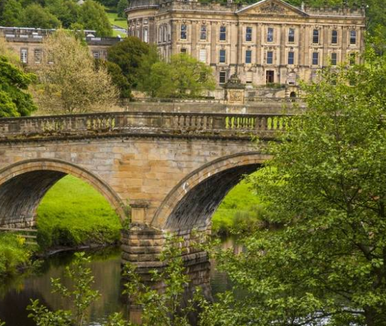
Highlight: Admire the grandeur of Chatsworth House, home to the Duke and Duchess of Devonshire, and its surrounding parkland landscaped by Capability Brown.

Option 2 – Along the Edges and Through Chatsworth Park to Bakewell

Distance: 10½ miles (17km) 

Ascent: 1,300 feet (400m) 

In summaryHigh up on the Moors we take an exhilarating walk along Froggatt, and Curbar Edge. Pass Wellington’s Monument descending to Chatsworth before passing through Edensor then over a ridge and down into Bakewell. 

HighlightThe gritstone escarpment of Curbar and Froggatt Edge is one of the most popular walks in the Peak District, with sweeping views over the Derwent Valley. 

Option 3 – Five Edges, Chatsworth Hunting Tower and on to Bakewell

Distance: 12 miles (19km) 

Total ascent: 1,050 feet (320m) 

In summaryThe fantastic gritstone edges see us all the way from Froggatt to Baslow Edge. We continue along Birchen Edge to reach the Hunting Tower and a descent to Chatsworth House, passing the Sowter Stone and aqueduct on the way. We end at Bakewell, via Edensor. 

HighlightA walk of great contrasts – magnificent high-level walking along the edges, and a more in-depth exploration of the Chatsworth estate.

Accommodation: The Peveril of the Peak (B, L, D)

Day 6High Peak Trail and Carsington

Option 1 – Carsington Water Circular

Distance: 7½ miles (12.5km) 

Ascent: 700 feet (220m) 

In summary: Starting at the Visitor Centre we will complete a circuit of Carsington Reservoir, induding walking over the dam. Carsington reservoir is the 9th largest in England.  

Highlight: Carsington Water is home to an abundance of birdlife. Stop at the bird hide to look out for Oystercatchers, Redshank, Terns and Geese.

Option 2 – Middleton Top, Harboro Rocks to Carsington

Distance: 7½ miles (12.5km)

Total ascent: 900 feet (280m)

In summary: Starting from Middleton Top, we follow the High Peak trail, arriving at Harboro rocks, with its caves and stone seat. After time exploring the rocks, we continue past the windmills before reaching the reservoir.

Highlight: Exploring the rocky outcrops of Harboro.

Option 3 – Black Rock to Carsington

Distance: 9 miles (14.5km)

Total ascent: 1,200 feet (360m)

In summary: Starting at Black Rocks, this walk then ascends to reach the High Peak Trail. There will be time to explore the National Stone Centre and Middleton Top and then we’ll be following the easier walk over Harboro Rocks before reaching the reservoir.

Highlight: Exploring the contrasting Black and Harboro Rocks.

Accommodation: The Peveril of the Peak (B, L, D)

Day 7Dovedale

Option 1 – Dovedale Gorge

Distance: 7 miles (11km)

Ascent: 1,200 feet (360m)  

In summary: Beginning with a descent to the famous stepping stones we follow the River Dove to Milldale. Following the zig zag path we then return through pasture land high above the gorge.

Highlight: The famous limestone gorge of Dovedale is just a stone’s throw from our country house with its rock formations, caves and verdant flora.

Option 2 – Dovedale and Alstonefield

Distance: 9 miles (14.5km)

Ascent: 1,150 feet (340m)

In summary: We begin following the route of option 1 through the iconic Dovedale Gorge. From Milldale we ascend to the village of Alstonefield. We visit the Green Well before our return route takes us back across the river and on higher ground back to the country house.

Highlight: The dramatic Dovedale Gorge with its towering limestone pinnacles.

Option 3 – Dovedale and Narrowdale Hill

Distance: 12 miles (19km)

Ascent: 1,400 feet (420m)

In summary: Having first walked up the beautiful Dovedale Gorge and reached Alstonefield, our walk takes a high level loop north to Narrowdale Hill, before returning across the river and along the route of option 2. 

Highlight: Magnificent panoramic views from Narrowdale Hill

Accommodation: The Peveril of the Peak (B, L, D)

Day 8Departure Day

Enjoy a leisurely breakfast before making your way home. (B)

Version 3 Itinerary

Day 1Arrival Day

You’re welcome to check in from 4pm onwards. Enjoy a complimentary cream tea on arrival.

Accommodation: The Peveril of the Peak (T, D)

Day 2The central Dove Valley

Option 1 – Hartington Circular

Distance: 6 miles (10km) 

Ascent: 750 feet (220m)

In summary: This walk starts and finishes in Hartington, famous for its Stilton cheese. Footpaths lead to Beresford Dale and the Upper River Dove, passing Izaak Walton’s fishing hut before ascending gradually to the village of Biggin. From here, a scenic track with panoramic views leads back to Hartington.

Highlight: Visit the fantastic cheese shop in Hartington and sample their locally made products.

Option 2 – Alstonefield and the Tissington Trail

Distance: 7½ miles (12km) 

Ascent: 950 feet (300m)

In summary: Walking from Alstonefield in Staffordshire (The River Dove being the County Boundary) we descend to Milldale hamlet then North through Iron Tors Dale (the so-called missing link!) and then on to the Tissington Trail (the former LNWR railway) and on to Biggin and Hartington.

Highlight: Biggin Dale is a National Nature Reserve. Look out for early purple orchids and rare cowslips.

Option 3 – Hartington and Biggin

Distance: 11 miles (17.5km)

Ascent: 1,500 feet (480m) 

In summary: Setting off from the House we pass Thorpe Cloud to take in the dramatic Dovedale gorge to reach the hamlet of Milldale. From here we follow a similar route to option 1 ending in the beautiful village of Hartington.

Highlight: The dramatic Dovedale Gorge with its towering limestone pinnacles.

Accommodation: The Peveril of the Peak (B, L, D)

Day 3Around Ashbourne

Option 1 – Okeover Park and Mappleton

Distance: 6½ miles (10.5km)

Ascent: 850 feet (260m)

In summary: From the country house we drop onto the Dove Valley crossing historic Coldwall Bridge and ascend Marten Hill. We return through lovely Okeover Park to Mappleton walking along the Dove with fine views of Thorpe Cloud.

Highlight: Check out the unusual church in Mappleton.

Option 2 – The Mayfields

Distance: 10 miles (16km)

Ascent: 1,250 feet (380m)

In summary: Initially following the route of option 1, we then continue south on The Limestone Way reaching the cluster of Mayfield villages. Descending through Upper Mayfield to cross Hanging Bridge and return via Mappleton and the River Dove.

Highlight: Hanging Bridge with its grim history including Bonnie Prince Charlie’s retreat in 1745.

Option 3 – The Mayfields and Mappleton

Distance: 12½ miles (20km)

Ascent: 1,350 feet (420m)

In summary: Heading out along the route of option 2, we extend our walk continuing south along the Limestone Way before descending to the historical villages of Middle Mayfield and Church Mayfield. Our return route takes us via Hanging Bridge and Mappleton.  

Highlight: Hanging Bridge with its grim history including Bonnie Prince Charlie’s retreat in 1745.

Accommodation: The Peveril of the Peak (B, L, D)

Day 4Free day

A free day for you to explore the local area or to relax in the Country House. Our Discovery Points help you make the most out of your free day. There’s plenty of maps and a selection of the best local walking routes, as well as weather forecasts and public transport options – plus details about other places to visit. 

Accommodation: The Peveril of the Peak (B, L, D)

Day 5Tissington North

Option 1 – Tissington Village and Trail

Distance: 7½ miles (12km)

Ascent: 800 feet (240m)

In summary: We walk to the feudal village of Tissington on grassland and along the tree lined avenue. After exploring the village we make our way onto the Tissington Trail to the former Alsop en le Dale station before returning to the country house. 

Highlight: The charming estate village of Tissington, home of the FitzHerbert family for over 500 years.

Option 2 – Tissington and Alsop en le Dale

Distance: 10½ miles (17km)

Ascent: 1,200 feet (380m)

In summary: After visiting beautiful Tissington village our walk descends to Parwich and then ascends to reach the Tissington trail which we follow to Alsop en le Dale station before heading back to the country house.

Highlight: The famous Tissington Trail follows the route of the former London and North Western railway.

Option 3 – Tissington, Parwich and Milldale

Distance: 12½ miles (20km)

Ascent: 1,550 feet (480m)

In summary: We begin following the route of option 2 to the Tissington Trail, taking in the estate village of Tissington. We then descend to the River Dove which we follow through a quiet dale to reach Milldale. From here the walk ascends to meet a farm track which we follow back to the house.

Highlight: Quaint Tissington village and all its history is not to be missed. 

Accommodation: The Peveril of the Peak (B, L, D)

Day 6High Peak Trail & Carsington

Option 1 – Carsington Water Circular

Distance: 7½ miles (12.5km) 

Ascent: 700 feet (220m) 

In summary: Starting at the Visitor Centre we will complete a circuit of Carsington Reservoir, induding walking over the dam. Carsington reservoir is the 9th largest in England.  

Highlight: Carsington Water is home to an abundance of birdlife. Stop at the bird hide to look out for Oystercatchers, Redshank, Terns and Geese.

Option 2 – Middleton Top, Harboro Rocks to Carsington

Distance: 7½ miles (12.5km)

Total ascent: 900 feet (280m)

In summary: Starting from Middleton Top, we follow the High Peak trail, arriving at Harboro rocks, with its caves and stone seat. After time exploring the rocks, we continue past the windmills before reaching the reservoir.

Highlight: Exploring the rocky outcrops of Harboro.

Option 3 – Black Rock to Carsington

Distance: 9 miles (14.5km)

Total ascent: 1,200 feet (360m)

In summary: Starting at Black Rocks, this walk then ascends to reach the High Peak Trail. There will be time to explore the National Stone Centre and Middleton Top and then we’ll be following the easier walk over Harboro Rocks before reaching the reservoir.

Highlight: Exploring the contrasting Black and Harboro Rocks.

Accommodation: The Peveril of the Peak (B, L, D)

Day 7Ilam and Manifold

Option 1 – Blore and Ilam Circuit

Distance:  6 miles  (9 Km)

Ascent and descent:  935ft (285m)

In summary: The walk descends to cross the River Dove into Staffordshire on an historic bridge before ascending to the hamlet of Blore.   We then visit Ilam with it’s  Park, Hall and village before crossing back into Derbyshire and back to Peveril of the Peak.

Highlight: Blore and Ilam churches both have interesting memorials. In beautiful Ilam Park we can see the River Manifold as it emerges from its underground route.

Option 2 – Blore, Ilam and Musden

Distance: 9½ miles (15km)

Ascent: 1,350 feet (420m)

In summary: We head out on the Limestone Way from Thorpe, crossing the River Dove at Coldwall Bridge and ascend to Blore. The route then continues to ascend west with magnificent views of surrounding countryside to reach Calton. We then descend through Musden Wood to Rushley Bridge before taking the riverside path through the grounds of Ilam Hall and the village of Ilam. 

Highlight: Ilam village with its grand hall, pseudo alpine cottages and memorial cross.

Option 3 – Ilam and the Manifold Valley

Distance: 12½ miles (20km)

Ascent: 1,900 feet (600m)

In summary: Beginning along the Limestone Way to Blore, we then continue to ascend, skirting the hill of Musden Low, before reaching the village of Calton. From here, the path continues north with wonderful views all around. We descend Soles Hollow to reach the River Hamps and the Manifold Way. From the confluence of the Hamps and the Manifold, the walk ascends back to the Manifold Trail to Throwley Hall. We then return through historic Ilam.

Highlight: Enjoy the panorama from Blore church over the limestone plateau and Dove Dale, with the shapely peak of Thorpe Cloud guarding the entrance.

Accommodation: The Peveril of the Peak (B, L, D)

Day 8Departure Day

Enjoy a leisurely breakfast before making your way home. (B)

Dates and Prices
Version 1
Departure Dates
Per person (single or twin) Single in a double room
2025: April 4, 25 $2,630 $2,910
2025: May 30 $2,930 $3,210
2025: June 6, 20 $2,930 $3,210
2025: July 18 $2,930 $3,210
2025: August 8, 29 $2,930 $3,210
2025: September 26 $2,930 $3,210
Version 2
Departure Dates
Per person (single or twin) Single in a double room
2025: April 11 $2,630 $2,910
2025: May 6 $2,930 $3,210
2025: June 13 $2,930 $3,210
2025: July 4 $2,930 $3,210
2025: August 1, 22 $2,930 $3,210
2025: September 5 $2,930 $3,210
2025: October 17 $2,630 $2,910
Version 3
Departure Dates
Per person (single or twin) Single in a double room
2025: February 7, 28 $2,350 $2,630
2025: October 31 $2,350 $2,630

Pricing

Pricing is per person (pp) based on single/twin/double occupancy.

Supplement applied for single in a double room.

Rates are in $ CAD. Rates include room upgrade (better) and membership fees. 


Contact DHTour at 1-888-597-3519 or 905-639-9954 or dhtour@dhtour.ca to book.

Ask us for the best available pricing for your dates & choice of airline. We can assist in your travel to/from the Country House.

This tour is also available in 3 or 4 night duration. 

This holiday includes active sightseeing and you should expect to spend lots of time on your feet.

While every effort will be made to adhere to the described itinerary, we may occasionally vary the sequence shown here or substitute an alternative route to suit local conditions or for other operational reasons, potentially at short notice. Sometimes things happen beyond our control – the weather, traffic jams or changes at the places we visit. If we need to adjust your holiday programme, for whatever reason, your leader will help smooth the way.

Travel Details:
Address is: The Peveril of the Peak, Thorpe, Dovedale, Ashbourne, Derbyshire DE6 2AW

By Rail:
The nearest railway stations are Buxton or Derby.

By Taxi:
From Buxton railway station a taxi takes approximately 45 minutes and costs around £42 if pre-booked. From Derby railway station a taxi takes approximately 40 minutes and costs around £32 if pre-booked. Please note these are 2020 prices relevant to a 4-seat taxi and should only be taken as a guide. 8-seat taxis can be booked at a higher rate. Ashbourne Taxis, our current recommended taxi company, can confirm prices on booking and will arrange shared taxis wherever possible. Please pre-book your taxi at least 7 days in advance by contacting:

Ashbourne Taxis*
Tel: +44 (0) 1335 345198
Mob: +44 7811 196686
Email: ashbourne-taxis@hotmail.co.uk
The return taxi journey can be arranged on your behalf by the Peveril of the Peak Manager.
*Ashbourne Taxis is not owned or managed by us.

By Bus:
There is a bus service as far as Ashbourne, about 3 miles from our country house. From Buxton take the 442 service or from Derby catch the SW1 service.
From Ashbourne complete your journey by taxi, or use the Derbyshire Connect service (01335 342951). The taxi service must be pre-booked in advance by calling 01335 345198 the journey will take approximately 10 minutes and costs £8 for a 4-seat taxi.

By Car:
From the south leave the M1 at junction 24 and head to Ashbourne via the A50 and A515. Continue north on the A515 heading towards Buxton. 1 mile north of Ashbourne turn left, signposted to Thorpe, Dovedale and Ilam. After a further 2 miles the road bends sharply left by the Old Dog pub. The Peveril of the Peak lies ahead at the bottom of the hill. Look out for the sign. From Buxton take the A515 south towards Ashbourne. After 17 miles turn right at a crossroads, following signs to Thorpe. After 1 mile turn right by the Old Dog pub. The Peveril of the Peak lies ahead at the bottom of the hill. Look out for the sign.

From the west leave the M6 at junction 15 and head via the A50, Cheadle (A521) and Oakamoor (A5417) to the A52. At the junction of the A52 and the A523 take the minor road signposted to Ilam. After 1½ miles turn left and descend the hill. Cross the bridge at Ilam, turn right and follow the road up a steep hill and onwards through Dovedale and Thorpe village. The Peveril of the Peak is on the left hand side at the end of the village.

From Buxton take the A515 south towards Ashbourne. After 17 miles turn right at a crossroads, following signs to Thorpe. After 1 mile turn right by the Old Dog pub. The Peveril of the Peak lies ahead at the bottom of the hill. Look out for the sign.

Hotel Descriptions
3

The Peveril of the Peak

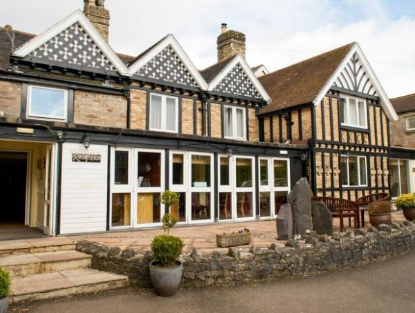
The Peveril of the Peak, named after Sir Walter Scott’s novel, stands proudly in the Peak District countryside, close to the village of Thorpe. Backed by the cone of Thorpe Cloud, which guards the entrance to Dovedale Gorge and the famous stepping stones at the entrance to the gorge, it’s an ideal base for people hoping to explore the Derbyshire countryside. Surrounded by extensive grounds and rolling countryside, it’s a picturesque retreat with 46 rooms, large shared spaces and a pleasant bar. Stride out from the house to find Dovedale’s wooded ravine, cave-like Dove Holes and of course stepping stones. Upstream lie the heights nicknamed the Dovedale Castle and the Twelve Apostles, best viewed from the grassy spur called Lovers’ Leap. While the Peak bit of the area name refers to small English hills rather than great summits, there’s superb walking to be had on the Roaches and the gritstone escarpment of Stanage Edge, while Chatsworth, Tissington and Bakewell make attractive places to explore too.

Address: The Peveril of the Peak, Thorpe, Dovedale, Ashbourne, Derbyshire DE6 2AW

Room Amenities: Tea & coffee-making facilities, TV, Hairdryer, Toiletries, Wi-Fi

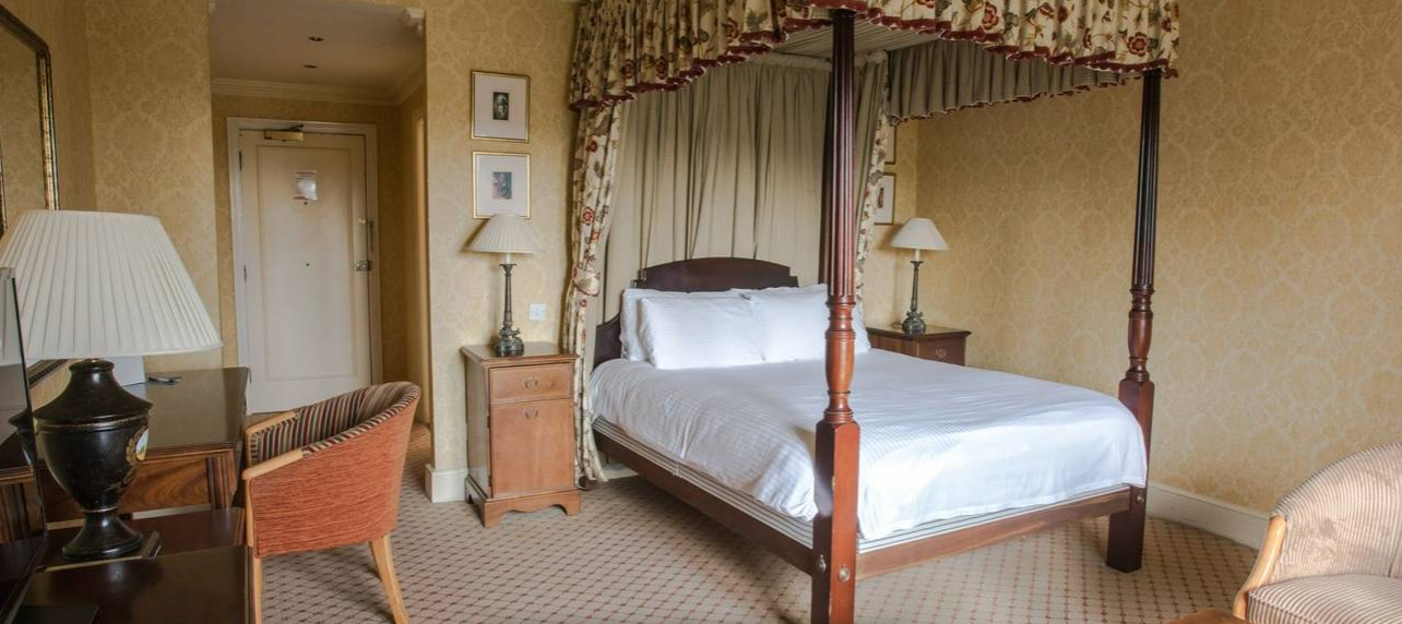
Stay in the smartly presented rooms in the main house. With 46 rooms, Peveril of the Peak has plenty of space and there’s a range of ‘Classic’ and ‘Premium’ Rooms to choose from. Room 2 on the ground floor (accessible via 7 steps down from reception) is spacious and attractively styled with a door opening on to the grounds while the Chatsworth Room has a four-poster bed to recline on.

Premium Rooms are more spacious en-suite guest rooms. Amenities include free Wi-Fi, tea and coffee-making facilities, toiletries (hand wash, shampoo, body lotion, shower gel), and a 32-inch TV. Extras include bathrobes, slippers, and comfortable mattresses.

Hotel Amenities: Free Wi-Fi, boot room and drying room, extensive garden, lounge, bar, ballroom, library and board games to borrow

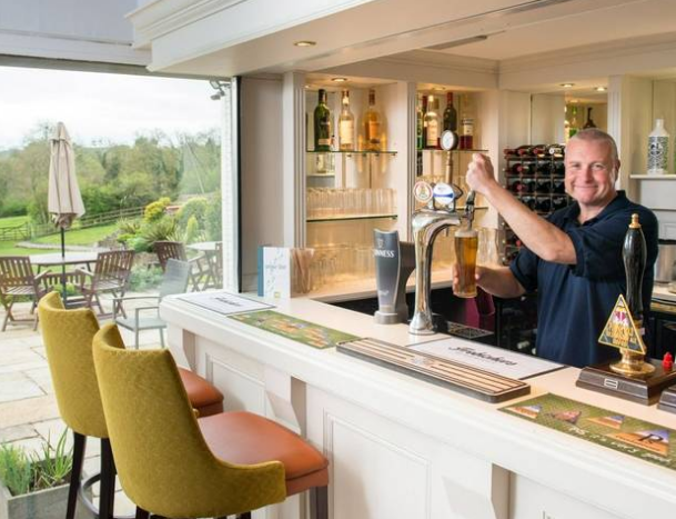
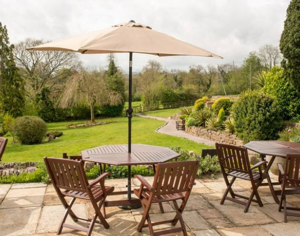
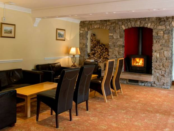
After a day delving into the Dovedale Gorge or exploring the Peak District, return to the house. Relax on the patio with a coffee or cold drink and soak up the wide-ranging countryside views. Take a turn through the garden and look out for the small canon on one of the lawns. Make your way inside to sit comfortably in the lounge where there’s a stash of wood and a log burner for those colder days or snag a seat in the bar with your fellow guests and sip a great local ale by the large windows.

Map

Photos
From$2,350 pp
Book Now