Shropshire Hills Guided Walking Tour 2025

0
Price
From$2,350 pp
Price
From$2,350 pp
Full Name*
Email Address*
Your Enquiry*
* I agree with Terms of Service and Privacy Statement.
Please agree to all the terms and conditions before proceeding to the next step
Save To Wish List

Adding item to wishlist requires an account

1981

Why Book With Us?

  • Over 24 years of exceptional service
  • Hand-Picked tours & accommodations
  • Preferred Suppliers & Rates

Contact us...

Our experienced travel designers are ready to arrange your travels.

1-888-597-3519

905-639-9954

[email protected]

8 Days / 7 Nights
Availability : February to December
Start: Longmynd House, Church Stretton, Shropshire, England
End: Longmynd House, Church Stretton, Shropshire, England
Shropshire Hills Guided Walking Tour: 7 nights based at Longmynd House, Church Stretton, Shropshire

Contact DHTour at 1-888-597-3519 or 905-639-9954 or [email protected] to book.

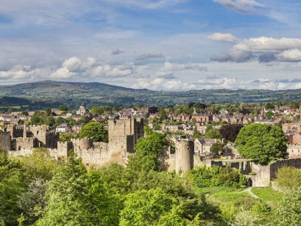
There’s something enchanting about the Shropshire Hills, the so-called ‘Little Switzerland’ covering almost a quarter of the county. Every footstep on this guided walking holiday rewards with stunning views; think ruined castles folded into hillsides, rare wildlife roaming the upland heaths, and a selection of postcard-worthy market towns and villages perched on the River Severn.

Tour Details

Highlights:

  • Discovering the immense beauty of the Shropshire Hills on foot
  • Visiting picturesque market towns and villages 
  • Learning more about this National Landscape
  • Making the most of the V-shaped valleys and countryside
  • Spending time with like-minded people in the great outdoors
  • Staying at Longmynd House in Church Stretton

Pick Up Location & TIme

Longmynd House, Cunnery Road, Church Stretton, Shropshire SY6 6AG (Google Map)
4:00pm – You’re welcome to check into the country house hotel from 4pm onwards.

Drop off Location & Time

Enjoy a leisurely breakfast before making your way onward.

Price Includes

  • High quality en-suite upgraded accommodation at Longmynd House
  • Excellent food in our country house, full board (B,L,D daily)
  • The services of our knowledgeable leader, ensuring you get the most from your holiday
  • 5 days guided walking + 1 free day
  • Choice of up to three guided walks each walking day
  • Transport to and from the walks
  • Use of our comprehensive Discovery Point

Meals

  • 7 breakfasts
  • 6 lunches
  • 7 dinners
  • 1 tea

Price Excludes

  • Airfare
  • Transfers
  • Pre / Post hotel nights
  • Travel to/from the Country Hotel (The nearest railway station is Church Stretton)
  • Admissions (please allow approx. £10 per day, per person for entrances)
  • Driver / Tour Leader gratuity is at your discretion
  • Travel Insurance
What to Expect
Shropshire Hills Guided Walking Tour Walking Grade: 2, 3 & 4.

Enjoy a full day’s walking with fellow guests and leave all the planning and navigation to us; it’s what we do best. Nobody knows the UK’s best places to walk like us. Our knowledgeable leaders make sure you’re never short of the inside story on local features, viewpoints and places of interest.

  • Unpack once
  • Accommodation at a country house hotel
  • Full Board Meals – from dinner on arrival day to breakfast on departure day
  • Knowledgeable leader
  • Choice of up to 3 walks per walking day with required transport

On our Guided Walking holidays, we believe that choice is key. Our walks descriptions will help you choose according to your interests and fitness. The walks are grouped together with care by local experts to give the best experience. 

Walking Grades Explained:

  • Grades 1 & 2 – Leisurely walking grades
  • Grades 3 & 4 – Moderate walking grades
  • Grades 5 & 6 – Challenging walking grades
What to Bring

“There’s no such thing as bad weather, just the wrong type of clothing!” goes the adage. Come prepared for all eventualities and you’ll walk in comfort as well as safety. Britain’s famous for its changeable weather, so here’s our advice on what to wear and bring.

Essentials

  • Waterproof walking boots providing ankle support and good grip.
  • A waterproof jacket and over-trousers
  • Gloves and a warm hat (it can be chilly at any time of the year)
  • Rucksack
  • Water bottle (at least 1 litre capacity)
  • A small torch (everywhere in winter, year round in mountains)
  • Sun hat and sunscreen
    Denim jeans and waterproof capes are not suitable on any walks.

Recommended

  • Several layers of clothing, which can be added or removed
  • Specialist walking socks to avoid blisters.
  • A first aid kit inc plasters– your leader’s first aid kit doesn’t contain any medication
  • Sit mat (insulated pad to sit on when you stop for a break)

You might also want

  • Walking poles, particularly useful for descents.
  • Insect repellent
  • Flask for hot drinks
  • Rigid lunch box
  • Gaiters
  • Blister kit (eg Compeed) just in case
  • Waterproof rucksack liner
Version 1 Itinerary

Day 1Arrival Day

You’re welcome to check in from 4pm onwards. Enjoy a complimentary cream tea on arrival.

Accommodation: Longmynd House (T, D)

Day 2Long Mynd

Option 1 – Townbrook & Cardingmill Valley

Distance: 6.7 miles (10.7km)

Ascent: 1,350 feet (410m)

In summary: Leaving Longmynd House we make our way through Rectory Woods and up the beautiful Townbrook Valley to reach the Long Mynd plateau and its highest point at Pole Bank. We then make our way north along the historic Port Way before descending into the scenic Carding Mill Valley and back to Longmynd House.

Highlight: Panoramic views from Pole Bank across Shropshire, mid Wales and beyond.

Option 2 – Along the Long Mynd

Distance: 8½ miles (13.5km)

Ascent: 1,450 feet (440m)

In summary: Head to the top of the Long Mynd via Townbrook Valley. We then head south along the ridge to Minton Hill, before returning to our country house via the village of Little Stretton.

Highlight: The beautiful Townbrook Valley and Long Mynd plateau with its 360 degree panoramic views.

Option 3 – Callow Hill, Pole Bank & Adstone Hill

Distance: 12 miles (19km)

Ascent: 2,450 feet (740m)

In summary: Our walks heads out towards Little Stretton before ascending Long Mynd via Callow Hill to reach its highest point at Pole Bank. We then descend the western slopes to Adstone Hill before returning over the Long Mynd and down Townbrook Valley to Church Stretton.

Highlight: The ascent via Callow Hill to Pole Bank is less frequented and gives extensive far reaching views.

Accommodation: Longmynd House (B, L, D)

Day 3Hopesay, Stokesay and Craven Arms

Option 1 – Three Woods and Stokesay Castle

Distance: 5 miles (8.5km)

Total ascent: 600 feet (180m)

In summary: This walk leaves from the village of Craven arms, taking in the surrounding Shropshire countryside and the river Onny. There is also chance to see Stokesay Castle before returning to allow time to explore the Shropshire Hills Discovery Centre.

Highlight: Discover Stokesay Castle and the Shropshire Hills Discovery centre

Option 2 – Aston on Clun & Stokesay

Distance: 7½ miles (12km) 

Total ascent: 900 feet (280m) 

In summary: Walk from the village of Aston on Clun to Craven Arms. On the way we’ll discover the historic 13th Century church at Hopesay, soak up the views from Hopesay Hill, and visit Stokesay Castle. 

Highlight: Stokesay Castle is a real gem; a 13th Century fortifed manor house that was beseiged during the English Civil War.

Option 3 – Bury Ditches Fort, Hopesay, Craven Arms

Distance: 11½ miles (18km)

Ascent: 1,900 feet (575m)

In summary: From Clunton walk through Steppleknoll Wood and then on to Bury Ditches Hill Fort. We continue past the pretty village of Hopesay to Stokesay and the Craven Arms.

Highlight: Explore the tranquil landscape of the Clun Valley and Bury Ditches Hill Fort.

Accommodation: Longmynd House (B, L, D)

Day 4Free day

A free day for you to explore the local area or to relax in the Country House. Our Discovery Points help you make the most out of your free day. There’s plenty of maps and a selection of the best local walking routes, as well as weather forecasts and public transport options – plus details about other places to visit. 

Accommodation: Longmynd House (B, L, D)

Day 5Stretton Hills

Option 1 – Hope Bowdler & Helmeth Wood

Distance: 6½ miles (10.5km)

Ascent: 1,300 feet (400m)

In summary: Starting from Longmynd House, we walk through the wooded lower slopes of Hazler Hill before a moderately steep ascent to the Gaer Stone and Hope Bowdler Hill. Heading down to the valley between Hope Bowdler and Caer Caradoc we make our way back along the old Cwms Lane, through Helmeth Wood and Church Stretton.

Highlight: Stunning views in all directions from the summit of Hope Bowdler Hill.

Option 2 – Ragleth Hill & Chelmick

Distance: 7½ miles (12km)

Ascent: 1,150 feet (360m)

In summary: Starting with a visit to the pretty village of Little Stretton, we tackle a sharp ascent to the summit of Ragleth Hill, where we are rewarded with stunning 360 degree views. Following the grassy ridge to its northern end, we head down to Chelmick Valley and the village of Hope Bowdler before returning to Longmynd House via the lower slopes of Hope Bowdler Hill and Helmeth Hill.

Highlight: Panoramic 360 degree views from Ragleth Hill (which can be seen clearly from the dining room at Longmynd House) across Shropshire and beyond.

Option 3 – Ragleth Hill, Chelmick and Hope Bowdler Hill

Distance: 9½ miles (15.5km)

Ascent: 1,750 feet (540m)

In summaryWalking through the pretty village of Little Stretton we cross the valley to make a sharp ascent to the summit of Ragleth Hill. We follow its grassy ridge northwards before descending to Chelmick valley and the village of Hope Bowdler. We then ascend steadily across Hope Bowdler Hill to reach Willstone Hill and the famous Battle Stones from where we return to Longmynd House via the Gaer Stone and lower slopes of Helmeth Hill.

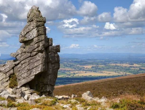
Highlight: The much photographed natural rocky outcrops of the Battles Stones and the Gaer Stone.

Accommodation: Longmynd House (B, L, D)

Day 6Ludlow & Mortimer Forest

Option 1 – Bromfield, Priors Halton & Ludlow

Distance: 5½ miles (8.5km)

Ascent: 400 feet (120m)

In summary: Starting from close to Bromfield, we follow a section of the Shropshire Way trail today as we explore the Shropshire countryside making our way to the town of Ludlow. We should finish with time to explore Ludlow.

Highlight: Time to explore Ludlow, described by John Betjeman as “probably the loveliest town in England”

Option 2 – Bromfield, The Mortimer Trail & Ludlow

Distance: 7½ miles (12km) 

Total ascent: 1,050 feet (320m) 

In summary: A longer exploration from Bromfield, we head into the lower areas of the Mortimer Forest, along the Mortimer Trail. Before looping around and heading into the town of Ludlow.

Highlight: Ludlow is one of England’s finest market towns with its array of black and white timbered buildings, overlooked by an impressive castle.

Option 3 – Downton Castle, Mortimer Forest & Ludlow

Distance: 10 miles (16.5km)

Ascent: 1650 feet (500m)

In summary: Our route follows field paths through rolling countryside before ascending to the Mortimer Forest and its highest point, High Vinnals. Continuing through the forest we descend towards the River Teme. Following the Bread Walk along the riverside, we enter the town via Dinham Bridge.

Highlight: Enjoy fine views and Ludlow and its castle.

Accommodation: Longmynd House (B, L, D)

Day 7Darnford Valley & Betchcott Hills

Option 1 – Darnford Valley & Betchcott Hills

Distance: 7 miles (11.5km)

Ascent: 1,050 feet (320m)

In summary: Our route follows the beautiful Darnford Valley, then the ancient Port Way heads over the Betchcott Hills to cross the Long Mynd plateau, before descending via Haddon Hill and the golf course, one of the highest in England, and return to the house.

Highlight: Enjoy the tranquility of the Darnford and Golden Valleys, the latter aptly named from the vibrant colour of the dwarf gorse bushes lining its slopes.

Option 2 – Gatten Hills & Darnford Valley

Distance: 9 miles (14.5km)

Ascent: 1,350 feet (420m)

In summary: Cross Gatten Hill, then ascend steadily along Darnford Valley to reach the ancient Port Way, cross the Long Mynd ridge and head to Church Stretton close to Bodbury Hill.

Highlight: The heather-clad ridge of the Long Mynd dominates the skyline. Enjoy the extensive views as you cross the ridge and descend towards Church Stretton.

Option 3 – Pulverbatch, Wilderley Hill & Darnford Valley

Distance: 13 miles (20.5km)

Ascent: 2,150 feet (660m)

In summaryFollow the Shropshire Way from the village of Church Pulverbatch over Wilderley Hill. Our route passes by the village of Ratlinghope and along the Darnford Valley to reach the Port Way and Long Mynd from where we descend via Haddon Hill and the golf course, overlooking the ever popular Carding Mill Valley, to Church Stretton.

Highlight: On a clear day you’ll enjoy sweeping views across Shropshire and the Welsh hills.

Accommodation: Longmynd House (B, L, D)

Day 8Departure Day

Enjoy a leisurely breakfast before making your way home. (B)

Version 2 Itinerary

Day 1Arrival Day

You’re welcome to check in from 4pm onwards. Enjoy a complimentary cream tea on arrival.

Accommodation: Longmynd House (T, D)

Day 2Caer Caradoc & the Lawley

Option 1 – Slopes of Caer Caradoc

Distance: 7 miles (11km) 

Ascent: 1,150 feet (360m)

In summary: A lovely route around Church Stretton. Heading across the valley towards the Stretton Hills we wind our way up the Cwms Valley along the scenic path which runs around the slopes of Caer Caradoc Hill.

Highlight: Enjoy the panoramic views of Church Stretton, Long Mynd and Stretton Hills.

Option 2 – Caer Caradoc and Back

Distance: 9.5 miles (15km)

Ascent: 1,700 feet  (520m)

In summary: From Longmynd House we descend to Church Stretton and along the Cwms Valley, from here we’ll ascend steeply to the summit of Caer Caradoc. Descending to the hamlet of Comley we skirt westwards and return through the Village of All Stretton along country lanes and back to the house.

Highlight: Reaching the summit of Caer Caradoc and seeing the Ancient British Iron Age Hill Fort which occupies the entire area. 

Option 3 – The Lawley and Caer Caradoc

Distance: 11.5 miles (18.5km)

Ascent: 2,300 feet (700m)

In summary: A walk that takes in the iconic Caer Caradoc, with on its summit the earthworks of an iron age fort. Followed by ascending the Lawley to walk its fine ridge before heading back west to traverse the lower slopes of the Long Mynd to return to Longmynd House.

Highlight: Walking the ridge of the Lawley providing extensive views.

Accommodation: Longmynd House (B, L, D)

Day 3The Stiperstones

Option 1 – Beneath the Stiperstones

Distance: 7 miles (11km)

Ascent: 850 feet (260m)

In summaryWe start our walk at the foot of Corndon Hill, with a visit to the Mitchell’s Fold Bronze Age Stone Circle. Our route takes us along the border between England and Wales before heading east to reach The Bog. We traverse the lower slopes of the distinctive quartzite Stiperstones ridge before descending to the village of Stiperstones.

Highlight: Mitchell’s Fold Bronze Age Stone Circle set in dramatic moorland.

Option 2 – The Stiperstones Ridge

Distance: 9 miles (14.5km)

Ascent: 1,300 feet (400m)

In summaryOur route starts with a visit to Mitchell’s Fold Bronze Age Stone Circle. From there we follow paths and tracks eastwards crossing Mucklewick Hill and passing by Nipstone Rock to reach the Stiperstones ridge. We traverse the rugged quartzite ridge and its iconic outcrops before descending steeply to the village of Stiperstones.

Highlight: The rocky and spectacular landscape of the Stiperstones ridge.

Option 3 – Stapeley Hill & The Stiperstones

Distance: 10½ miles (17km)

Ascent: 1,500 feet (460m)

In summary: A longer route, taking in Mitchell’s Fold Bronze Age Stone Circle before crossing Stapeley Hill, Mucklewick Hill and passing by Nipstone rock to reach the geologically significant Stiperstones ridge. We also traverse the rugged quartzite ridge and its iconic outcrops before descending steeply to the village of Stiperstones.

Highlight: The Stiperstones summit epitomises the jagged beauty of the ridge.

Accommodation: Longmynd House (B, L, D)

Day 4Free day

A free day for you to explore the local area or to relax in the Country House. Our Discovery Points help you make the most out of your free day. There’s plenty of maps and a selection of the best local walking routes, as well as weather forecasts and public transport options – plus details about other places to visit. 

Accommodation: Longmynd House (B, L, D)

Day 5The Long Mynd Valleys

Option 1 – Batch Valley & New Pool Hollow

Distance: 6 miles (10km)

Ascent: 1,350 feet (480m)

In summary: Walk around the base of Novers Hill before heading higher up onto the Longmynd itself and visiting the extraordinary golf course found as high as any in England. We enter Cardingmill valley via a gentle path down the northern slope to visit New Pool Hollow with its picturesque reservoir before heading back to the house, passing through the peaceful Rectory Woods.

Highlight: Visit some of the oldest fossils ever discovered in New Pool Hollow.

Option 2 – All Stretton and Long Mynd

Distance: 7.1 miles (11.5km)

Ascent: 1,409 feet (431m)

In summary: Walking north along the base of The Longmynd, we pass the source of the famous Stretton Mineral Water to ascend steadily to Plush Hill and onto the ancient drover road known as The Portway. Walking along the heather moorland on the ridge of The Longmynd itself and then descending into Carding Mill valley before heading home to Longmynd House.

Highlight: Descending into Carding Mill Valley, the most famous valley in South Shropshire.

Option 3 – Ashes Hollow, Cwmdale and Carding Mill

Distance:  10 miles (16.5km)  

Total ascent: 2050 feet (620m)

In summaryLeaving from Longmynd House we head through the amazing Ashes Hollow Valley and take in the summit of Pole Bank. We then carry on heading towards All Stretton taking in Cwmdale and return to the house via Carding Mill.

HighlightTake in multiple valleys on this walk.

Accommodation: Longmynd House (B, L, D)

Day 6Wenlock Edge & Onny Valley

Option 1 – Flounders Folly & Wenlock Edge
Option 2 – Norton Camp, three woods, Stokesay Castle
Option 3 – Hopesay Common, Wart Hill, Stokesay

Accommodation: Longmynd House (B, L, D)

Day 7Over the Long Mynd

Option 1 – Bridges, Coates, Pole Bank, Townbrook
Option 2 – Hamperley, Churchmoor hill, Pole Bank, Townbrook
Option 3 – Linley, Norbury Hill, Coates, Pole Bank & Ashlet

Accommodation: Longmynd House (B, L, D)

Day 8Departure Day

Enjoy a leisurely breakfast before making your way home. (B)

Version 3 Itinerary

Day 1Arrival Day

You’re welcome to check in from 4pm onwards. Enjoy a complimentary cream tea on arrival.

Accommodation: Longmynd House (T, D)

Day 2The Stretton Hills

Option 1 – Slopes of Caer Caradoc

Distance: 7 miles (11km) 

Ascent: 1,150 feet (360m)

In summary: A lovely route around Church Stretton. Heading across the valley towards the Stretton Hills we wind our way up the Cwms Valley along the scenic path which runs around the slopes of Caer Caradoc Hill.

Highlight: Enjoy the panoramic views of Church Stretton, Long Mynd and Stretton Hills.

Option 2 – Hope Bowdler & Caer Caradoc

Distance: 9 miles (14km)   

Ascent: 1,950 feet (600m)

In summary: We cross the valley to ascend the long ridge of Hope Bowdler Hill. Our second summit is the distinctive Caer Caradoc Hill.

Highlight: Look out for the Iron Age hillfort on the summit of Caer Caradoc; said to be the site of King Caractacus’s final stand against the Roman invasion.

Option 3 – Around Caer Caradoc & Over the Lawley

Distance: 10½ miles (16.5km)

Ascent: 2,050 feet (620m)

In summary: We follow a track up along the Lawley ridge before reaching the summit of the Lawley where we will get great views over North Shropshire and the Cheshire Plains.

Highlight: Enjoy panoramic views to the North towards The Wrekin, east to Wenlock Edge, and West over the nearby Long Mynd Valley.

Accommodation: Longmynd House (B, L, D)

Day 3The Stiperstones

Option 1 – Beneath the Stiperstones

Distance: 7 miles (11km)

Ascent: 850 feet (260m)

In summaryWe start our walk at the foot of Corndon Hill, with a visit to the Mitchell’s Fold Bronze Age Stone Circle. Our route takes us along the border between England and Wales before heading east to reach The Bog. We traverse the lower slopes of the distinctive quartzite Stiperstones ridge before descending to the village of Stiperstones.

Highlight: Mitchell’s Fold Bronze Age Stone Circle set in dramatic moorland.

Option 2 – White Grit and Over the Stiperstones

Distance: 7½miles (12km)

Ascent: 1100 feet (340m)

In summaryFrom the foot of Corndon Hill we soon reach in Mitchell’s Fold Bronze Age Stone Circle. Our route then takes us eastwards to The Bog, from where we ascend the rugged Stiperstones quartzite ridge, passing its iconic outcrops before descending steeply to the village of Stiperstones.

Highlight: Discover the area’s rich history and geology as you learn about the lead and barytes mines and the quartzite rocks of the Stiperstones.

Option 3 – The Stiperstones Ridge

Distance: 9 miles (14.5km)

Ascent: 1,300 feet (400m)

In summaryOur route starts with a visit to Mitchell’s Fold Bronze Age Stone Circle. From there we follow paths and tracks eastwards crossing Mucklewick Hill and passing by Nipstone Rock to reach the Stiperstones ridge. We traverse the rugged quartzite ridge and its iconic outcrops before descending steeply to the village of Stiperstones.

Highlight: The rocky and spectacular landscape of the Stiperstones ridge.

Accommodation: Longmynd House (B, L, D)

Day 4Free day

A free day for you to explore the local area or to relax in the Country House. Our Discovery Points help you make the most out of your free day. There’s plenty of maps and a selection of the best local walking routes, as well as weather forecasts and public transport options – plus details about other places to visit. 

Accommodation: Longmynd House (B, L, D)

Day 5Pole Bank & the Long Mynd Valleys

Option 1 – Townbrook and Cardingmill Valley

Distance: 6½ miles (10.5km)

Ascent: 1,300 feet (400m)

In summary: Leaving Longmynd House we make our way through Rectory Woods and up the beautiful Townbrook Valley to reach the Long Mynd plateau and its highest point at Pole Bank. We then make our way north along the historic Port Way before descending into the scenic Carding Mill Valley and back to Longmynd House.

Highlight: Relax at the National Trust café in the Carding Mill Valley and enjoy the views of this local beauty spot.

Option 2 – Along the Long Mynd

Distance: 8½ miles (13.5km)

Ascent: 1,450 feet (440m)

In summary: Head to the top of the Long Mynd via Townbrook Valley. We then head south along the ridge to Minton Hill, before returning to our country house via the village of Little Stretton.

Highlight: The beautiful Townbrook Valley and Long Mynd plateau with its 360 degree panoramic views.

Option 3 – Callow Hill, Pole Bank & Adstone Hill

Distance: 12 miles (19km)

Ascent: 2,450 feet (740m)

In summary: Our walks heads out towards Little Stretton before ascending Long Mynd via Callow Hill to reach its highest point at Pole Bank. We then descend the western slopes to Adstone Hill before returning over the Long Mynd and down Townbrook Valley to Church Stretton.

Highlight: The ascent via Callow Hill to Pole Bank is less frequented and gives extensive far reaching views.

Accommodation: Longmynd House (B, L, D)

Day 6Stokesay and Hopesay Hill

Option 1 – Aston on Clun & Stokesay

Distance: 7½ miles (12km) 

Total ascent: 900 feet (280m) 

In summary: Walk from the village of Aston on Clun to Craven Arms. On the way we’ll discover the historic 13th Century church at Hopesay, soak up the views from Hopesay Hill, and visit Stokesay Castle. 

Highlight: Stokesay Castle is a real gem; a 13th Century fortifed manor house that was beseiged during the English Civil War.

Option 2 – Clunton & Hopesay Hill

Distance: 9½ miles (15km) 

Total ascent: 1,500 feet (460m) 

In summary: From Clunton walk over Merry Hill to join the Shropshire Way. We continue past the pretty village of Hopesay to Stokesay Castle then beside the River Teme to Craven Arms. 

Highlight: Explore the tranquil landscape of the Clun Valley. In the words of AE Housman, “Clunton and Clunbury, Clungunford and Clun, are the quietest places under the sun.” 

Option 3 – Bury Ditches Fort & Hopesay Hill

Distance: 11½ miles (18km) 

Total ascent: 1,900 feet (575m) 

In summary: From Clunton walk through Steppleknoll Wood and then on to Bury Ditches Hill Fort. We continue past the pretty village of Hopesay to Stokesay and the Craven Arms. 

Highlight: Explore the tranquil landscape of the Clun Valley and Bury Ditches Hill Fort.

Accommodation: Longmynd House (B, L, D)

Day 7Ludlow & Mortimer Forest

Option 1 – Around Ludlow

Distance: 5½ miles (8.5km)

Ascent: 800 feet (240m)

In summaryFrom Bromfield our route takes us through Oakly Park to the ancient Mortimer Forest. We then descend towards Ludlow and follow the historic Bread Walk alongside the River Teme before exploring this historic town.

Highlight: Ludlow, a historic market town described by John Betjeman as ‘probably the loveliest town in England’. 

Option 2 – Mortimer Forest

Distance: 6½ miles (10.5km)

Ascent: 900 feet (280m)

In summary: Leaving from Bromfield we pass through Oakly Park to reach the ancient Mortimer Forest. We then head further into the forest before descending along the secluded Mary Knoll Valley to enter Ludlow via the Ludford Bridge.

Highlight: Ludlow is one of England’s finest market towns with its array of black and white timbered buildings, overlooked by an impressive castle.

Option 3 – Mortimer Forest & Ludlow

Distance: 10 miles (16.5km)

Ascent: 1650 feet (500m)

In summary: Our route follows field paths through rolling countryside before ascending to the Mortimer Forest and its highest point, High Vinnals. Continuing through the forest we descend towards the River Teme. Following the Bread Walk along the riverside, we enter the town via Dinham Bridge.

Highlight: Enjoy fine views and Ludlow and its castle.

Accommodation: Longmynd House (B, L, D)

Day 8Departure Day

Enjoy a leisurely breakfast before making your way home. (B)

Dates and Prices
Version 1
Departure Dates
Per person (single or twin) Single in a double room
2025: April 4 $2,630 $2,910
2025: May 9, 30 $2,930 $3,210
2025: June 13 $2,930 $3,210
2025: July 18 $2,930 $3,210
2025: August 8, 29 $2,930 $3,210
2025: September 26 $2,930 $3,210
2025: October 24 $2,350 $2,630
Version 2
Departure Dates
Per person (single or twin) Single in a double room
2025: April 18 $2,630 $2,910
2025: May 16 $2,930 $3,210
2025: June 6 $2,930 $3,210
2025: July 4 $2,930 $3,210
2025: August 2 $2,930 $3,210
2025: September 12 $2,930 $3,210
2025: October 10 $2,630 $2,910
Version 3
Departure Dates
Per person (single or twin) Single in a double room
2025: February 7, 21 $2,350 $2,630
2025: March 7, 28 $2,350 $2,630
2025: October 31 $2,350 $2,630
2025: November 21 $2,350 $2,630
2025: December 5 $2,350 $2,630

Pricing

Pricing is per person (pp) based on single/twin/double occupancy.

Supplement applied for single in a double room.

Rates are in $ CAD. Rates include room upgrade (better) and membership fees. 


Contact DHTour at 1-888-597-3519 or 905-639-9954 or [email protected] to book.

Ask us for the best available pricing for your dates & choice of airline. We can assist in your travel to/from the Country House.

This tour is also available in 3 or 4 night duration. 

This holiday includes active sightseeing and you should expect to spend lots of time on your feet.

While every effort will be made to adhere to the described itinerary, we may occasionally vary the sequence shown here or substitute an alternative route to suit local conditions or for other operational reasons, potentially at short notice. Sometimes things happen beyond our control – the weather, traffic jams or changes at the places we visit. If we need to adjust your holiday programme, for whatever reason, your leader will help smooth the way.

Travel Details:
Address is: Longmynd House, Cunnery Road, Church Stretton, Shropshire SY6 6AG

By Rail:
The nearest train station is Church Stretton, which is less than a mile from Longmynd House. However the house is at the top of a steep hill (it has great views!) so a taxi is recommended.

By Taxi:
It is possible to pre-book a taxi. The journey from Church Stretton railway station takes approximately 15 minutes. You can pre-book a taxi from our recommended taxi company, Alan’s Cab. As a guide price, it cost £17 per 4-seat taxi in 2019. 8-seat taxis are also available at a higher rate. Please pre-book your taxi at least 7 days in advance by contacting:

Alan’s Cab*
Tel: +44 (0) 7970 683126
Email: [email protected]
The return taxi journey can be arranged on your behalf by the Longmynd HouseManager.
*Alan’s Cab is not owned or managed by us. 

NOTE: All taxi companies in Church Stretton are booked for school runs between 2pm and 4:30pm.

By Car:
Follow the A49 to Church Stretton. At the traffic lights turn off the A49 into the town. At the first T junction turn left into the High Street. Go straight over the mini-roundabout, and then take the next right into Cunnery Road. Follow the road up a steep hill and around a hairpin bend. Longmynd House is at the top of the hill on the left hand side. Look out for our sign. A car park is available in the grounds with free parking.

Hotel Descriptions
4

Longmynd House

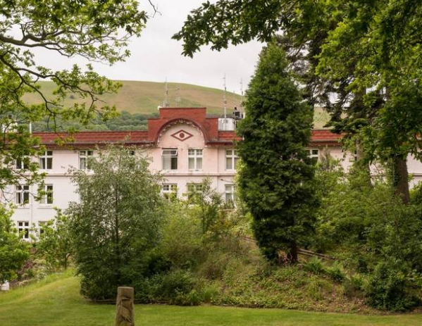
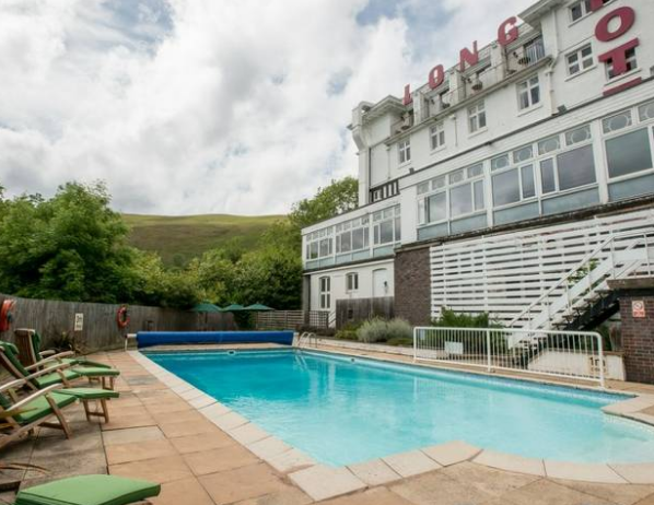
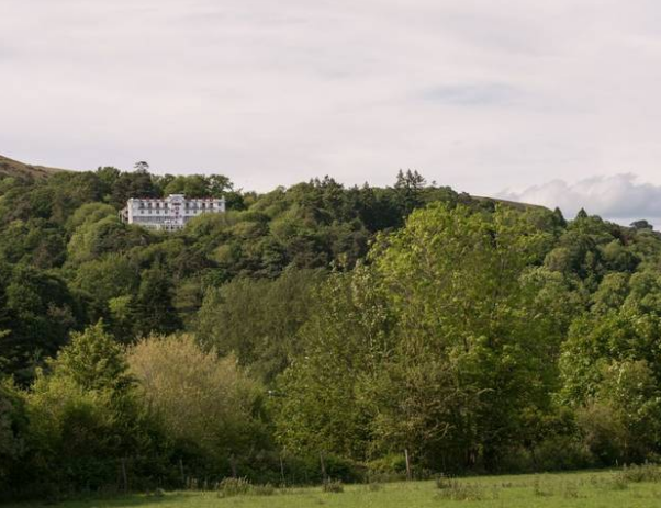
Hidden in plain sight, there’s a well-kept countryside secret in the heart of England that might just surprise you with its wonderful upland walking, trails, history and heritage. Discover the heart of Shropshire from striking Longmynd House, stood on a wooded hillside above Church Stretton, on the border of England and Wales. Wake early to watch the sunrise from your balcony; take a dip in the heated outdoor pool and gear up for a great day in the hills on walks full of rich variety. Stride out on the Long Mynd itself, a dramatic, isolated whaleback hill with an expanse of heather wilderness and deeply cut valleys, explore the Stiperstones and climb to the Iron Age fort on top of Caer Caradoc, or surround yourself with historic castles, market towns and trails of all kinds.

Room Amenities: Tea & coffee-making facilities, TV, Hairdryer, Toiletries, Wi-Fi

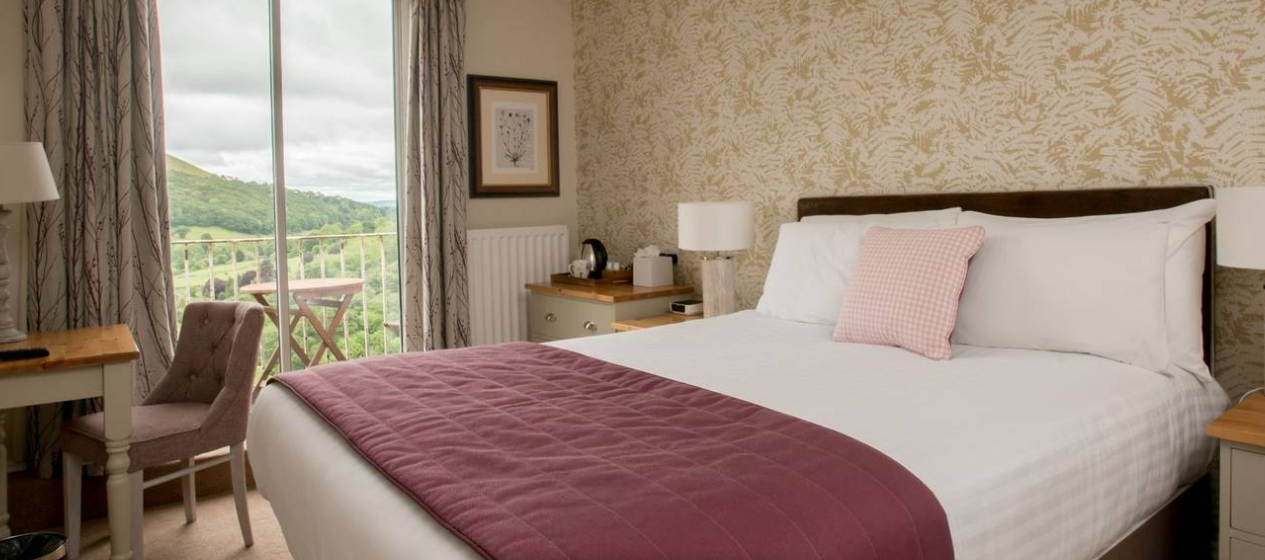
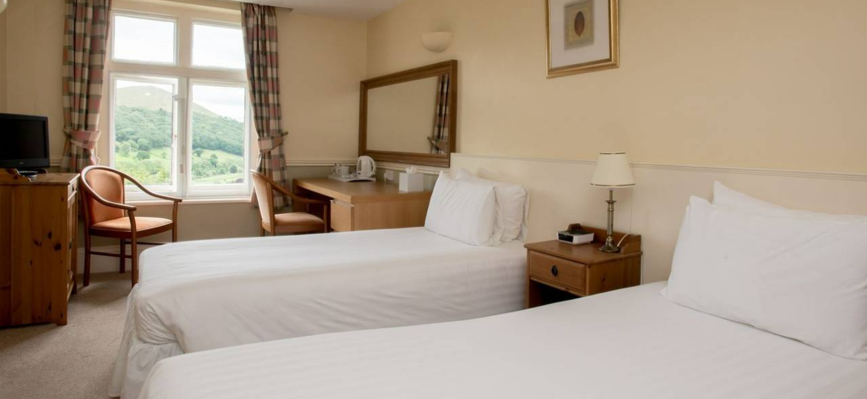
Stay in the smartly presented rooms in the main house or in one of 8 brick-built lodges in the grounds. With 54 rooms, Longmynd House has plenty of space and there’s a range of ‘Classic’ and ‘Premium’ Rooms to choose from. Chose Room 16 for the four poster bed and separate sitting area, with green leafy views or Room 44 with its compact balcony and outdoor eating area overlooking the heather-clad rise on the far side of the valley. The lodges away from the house offer a little more privacy and their own terrace looking out over the gardens.

Premium Rooms are more spacious en-suite guest rooms. Amenities include free Wi-Fi, tea and coffee-making facilities, toiletries (hand wash, shampoo, body lotion, shower gel), and a 32-inch TV. Extras include bathrobes, slippers, and comfortable mattresses.

Hotel Amenities: Free Wi-Fi, boot room and drying room, extensive garden, lounge, bar, ballroom, library and board games to borrow

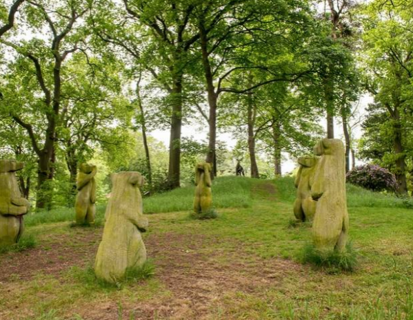
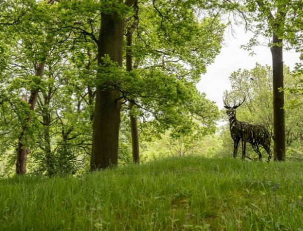
After a day exploring the Shropshire Hills, return to the house. Stroll through the extensive grounds and discover the woodland sculpture trail that threads through the trees, looking out for ‘deer’ and ‘bears’. Dip into the heated outdoor pool to swim below the trees. Head to the long lounge with its wall of glass giving on to the view outside, or for a more intimate space, sit at the smart bar with its crouching lions and attractive jug lamps or surrender to the leather sofas around the fireplace and enjoy a local pint of Shropshire Lad or Lass with a lively conversation among your fellow guests.

Map

Photos

Proceed Booking